Contact Us
Coat of Arms

Brief Data
  • Name:
  • Area:
  • Capital:
  • Currency:
  • Population:
  • National Day:
  • Republika Srbija
  • 88,361 km2
  • Belgrade
  • Serbian dinar
  • 9,396,411
  • 15 February

Detailed Map

Tourism
VisitSerbia.org

Other Facts:
  • Coordinates:
  • Lowest Pt.:
  • Highest Pt.:
  • Median Age:
  • Ethnicity:
  • and
  • 44 00 N, 21 00 E
  • N/A
  • Daravica 2,656 m
  • 40.4 years
  • Serb 66%
  • Albanian 17%
Introduction

It is the very first foreign country I have visited. I was taken there by my mother, on her numerous trips along with my grandfather and pretty much all the siblings and the neighbours we knew.

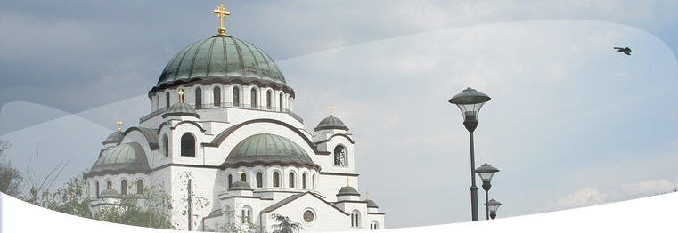
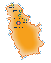
The year was 1990 and I haven't been there since. Back then, it still stood as Yugoslavia, although I only visited present region called Vojvodina, which is still part of Serbia. For the sake of accuracy and for not knowing precisely what dates we've been in each city, this is a list of all dates in the passport for the serbian trips: April 10,16 + May 13,21 + June 8,9,12,16,25,28 and August 17 of the year 1990.

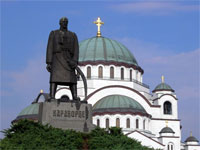
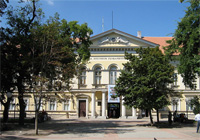
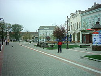
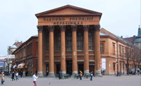
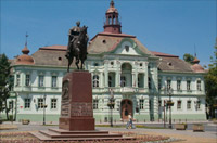
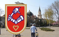
Places I've seen are: Subotica, Zrenjanin, Senta & Kikinda.

Belgrade11 - 12 September 2009

One of the oldest cities in Europe, with archeological finds tracing settlements as early as the 6th millennium BC, Belgrade's wider city area was the birthplace of the largest prehistoric culture of Europe, the Vinca culture. A settlement on today's location was founded in 3rd century BC by the Celts who named it the White City, which it still bears. The city lies on two international waterways, at the confluence of the Sava and Danube rivers, where Central Europe's Pannonian Plain meets the Balkans.

Pančevo ~ transit11 September 2009

The first historical record mentioning the town is from 1153 book of "Idrisia" when it was a mercantile harbour. The city was populated by Serbs and belonged to the Bulgarian Empire in the 9th and 11th century and later the Serbs until the 16th century, when it became part of the Ottoman Empire. During the Ottoman rule, the city was part of the Ottoman Province of Temesvar and was a large settlement mostly populated by ethnic Serbs.

Vršac ~ transit11 September 2009

Vršac is considered to be one of the most significant centers of agriculture in the region of southern Banat, which is the southern part of the province of Vojvodina. It is mainly because it has 54,000 hectares of arable and extremely fertile land in its possession. The city's Romanian minority have a Romanian-language theatre, schools and a museum. Romanian-language instruction takes place at a kindergarten, an elementary school, a high school and a university.

SuboticaSpring 1990

It is the largest city I've visited in Serbia so far. We've been there a few times, mostly driving thru the city and stoping at the main market. The trips took place in the spring of 1990. We'd usually get there after stoping in Senta, and on our way to Zrenjanin. The main reason for going there was to buy the very famous 96% alcohol, made locally.

ZrenjaninSpring 1990

Third largest city in Vojvodina, after Novi Sad and Subotica, Zrenjanin was home to our soon to be step father, Dragan. We went there one time, with Geo & Camelia, to visit Dragan's family. Quick drive thru the city, the main target being his house & back. Spent a whole afternoon, after which we went straight back to Romania. This is the last time I step on yugoslavian / serbian soil.

Kikinda & SentaSpring 1990

While always only passing thru Kikinda, Senta is definitely the city I spent most time while in Serbia. It's also the city that brings back the most exciting memories of international travel and free market commerce. The Coat of Arms of Kikinda represents impaled head of a Ottoman on a sabre, due to military contribution of population of Kikinda during a Austro-Turkish Wars.